
The Cathedral Valley district is the most challenging and least visited area of Capitol Reef. Two roughly parallel roads (Hartnet and Cathedral) trend southeast to northwest across Bureau of Land Management (BLM) land into the park and meet near one of the backcountry campgrounds in Capitol Reef. These roads require high-clearance, 4-wheel vehicles. Hartnet Road requires both a vehicle and a person capable of fording the Fremont River while Cathedral Road has a steep set of rocky switchbacks just before the campground. Of course cell phones don’t work at all here, and communication by park radio is only marginally better.
The ford was frequently impassable during the flash floods in August and September and was still rather deep when we finally had a chance to explore this area. Leaving our trailer shortly after breakfast, we drove east out of the park, up Cathedral Road to the campground, exited the park into National Forest land near Thousand Lakes Mountain, drove a bit further north and west, finally turned south and then east back to the park and our trailer, arriving just in time to make dinner. We had driven just over 100 miles.

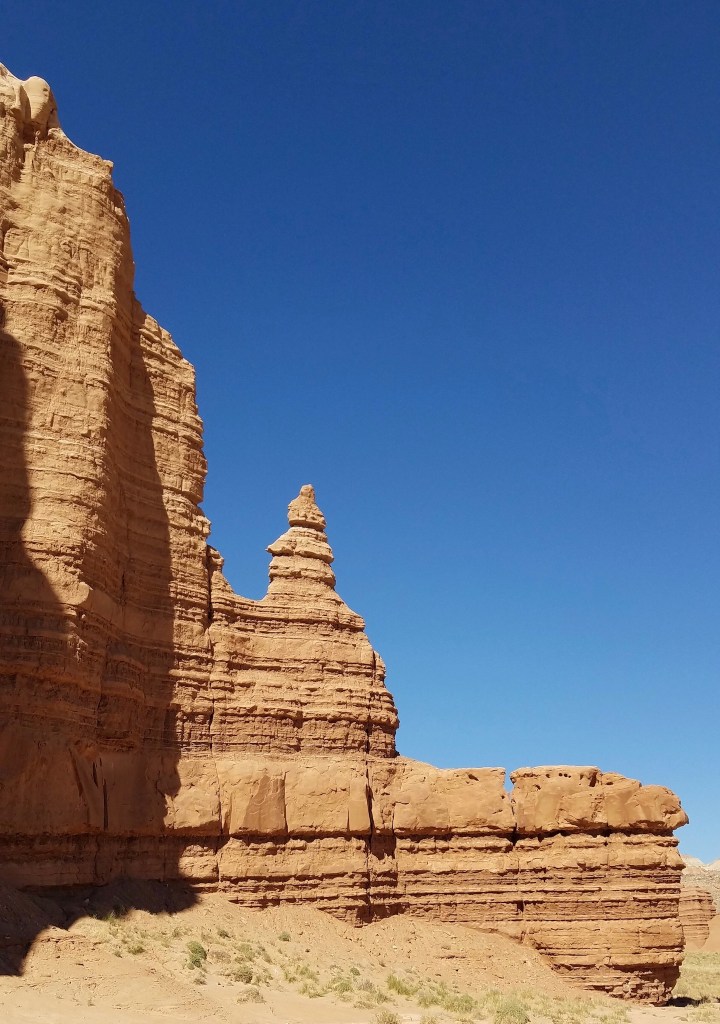
Although we stopped at Glass Mountain (lots of selenite sparkling in the sun), Gypsum Sinkhole (just what it sounds like it would be) and the campground (4 of 6 sites occupied), Temples of the Sun and Moon were the most spectacular – Entrada Sandstone monoliths rising from the desert floor.

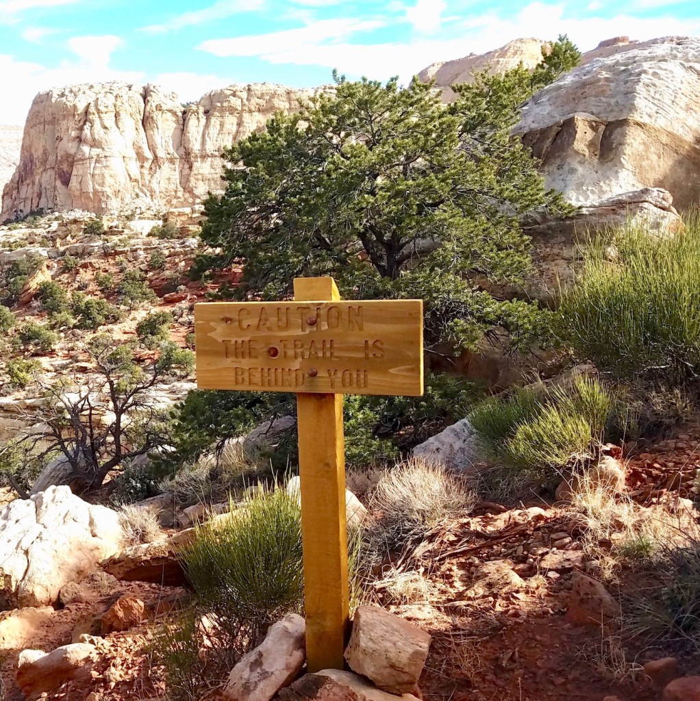
Perhaps the most unexpected sight was the following sign in the middle of the desert:

While we’ve seen signs on similar roads near Goblin Valley State Park and Arches National Park, it’s still a surprise to see that one can access an interstate highway from a 4-wheel drive dirt road.
A few weeks later, we headed south over Boulder Mountain to Escalante. There are two roads between Boulder and Escalante – Hell’s Backbone, a dirt road featuring a wooden bridge, and Highway 12, originally a shorter forest road that was reconstructed by the CCC in the 1930s and finally paved in the 1980s. We chose Hwy 12 with its stunning views and hair-raising hogback. Apparently we were so busy staying on the road (me) or ogling the scenery (Alan) that we have no photographs.

Once we arrived on the outskirts of Escalante, we stopped at the Escalante Heritage Center. This outdoor exhibit tells the story of the Hole in the Rock Expedition. About 250 Mormon settlers with about 80 wagons literally carved a trail through what is now Grand Staircase-Escalante National Monument on their way to Bluff. The journey, which began in December of 1879, was supposed to take six weeks. First they blasted a road through a narrow slot in the rocks and lowered wagons down to the Colorado River. They ferried the river after building rafts and then built another road up the other side. Six months after leaving Escalante they finally staggered into Bluff. This route was used to travel between Escalante and Bluff for over a year before someone discovered a less arduous path. The current 4-wheel drive road into the monument pretty much follows the route the pioneers took as far as Hole in the Rock at which point you can (or perhaps used to be able to) see Lake Powell.
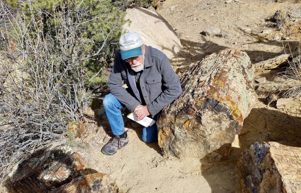
Instead of driving to Hole in the Rock, we stayed on Hwy 12 to Escalante Petrified Forest State Park. The trail to the petrified forest switchbacks up the hillside, but once up on top, petrified wood is everywhere. And we actually took some photos!

There was one more trail that we had to do before leaving Capitol Reef. When we first arrived in August, it was too hot. Then the monsoon arrived and wiped out the road. Finally, the stars aligned. We drove down to Grand Wash in the car and hiked towards Cassidy Arch. Half a mile from the arch we took the righthand junction onto the Frying Pan trail. It went up and over, down and around and finally connected to the Cohab trail. You may remember the Cohab trail from our previous post. It starts (or ends in this case) across the road from the campground. We hopped in the truck and drove back down to Grand Wash to collect the car.

We were happy to be hiking on a cool day as there isn’t much shade on the Frying Pan. In many places the trail crosses bare rock so one must look for cairns or signs to stay on course. A bit of a challenge but overall a delightful trail!
In the previous post we mentioned that temperatures had been above average for weeks, but we suspected we would pay for that. We were right. In mid-October, the temperatures dropped quickly, and by the second week in November the nighttime temps were in the 20s. It was pretty chilly driving around in our open golf cart.
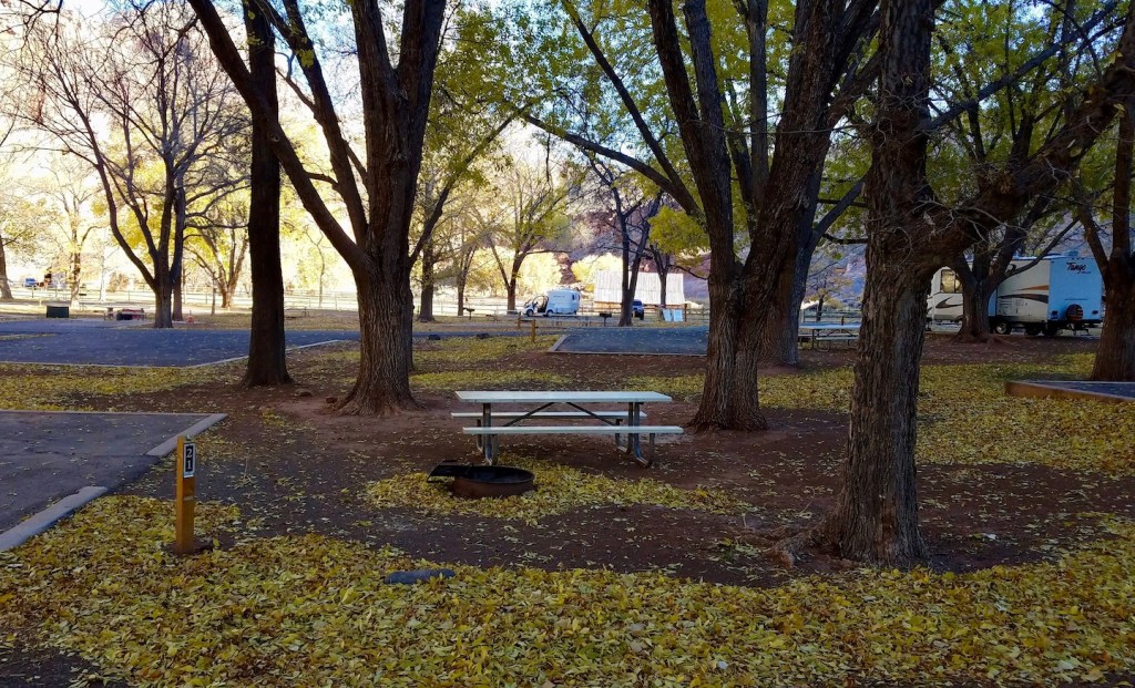
At the beginning of October four sets of volunteers lived in the campground. Trail patrol volunteers left first, a few days before Halloween. Our co-hosts left next, followed by the visitor center volunteer and her husband. We stayed as the campground moved from reservation-only to first-come, first-served. Everyone expected the campground to remain quite full, but that didn’t happen. In the photo below, our trailer is the the middle. And those leaves? 95% of them fell over one night. It sounded like it was raining! We decided it was time to head back to Colorado.
The drive home was uneventful. My sister, her husband and their cats were waiting for us with a home-cooked dinner. We timed it perfectly as it snowed a couple of days after arriving. And then it snowed again, and again. A week later we were finally able to move Velocity into storage.
Although we had a great time hosting in Capitol Reef, we’re not planning to host anywhere in 2023. We’re instead looking forward to a whole season of gardening and fishing plus the usual day hikes in the Colorado mountains. And it looks as if we’ll be heading to the Northwest in June and again in the fall. Finally, we figure we’ve lived in the trailer over 700 days in the almost 8 years since it was built so it’s time to do some repairs before the next adventure. We’ll keep you posted!

